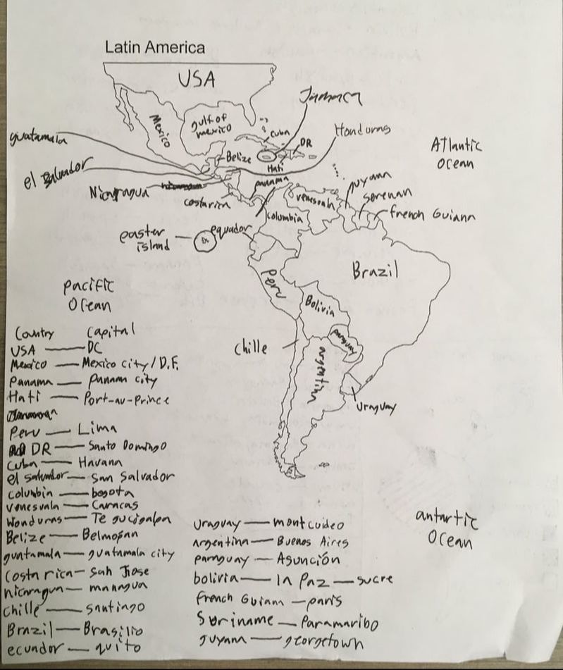
Latin America Map
|
|
The vast majority of intra-immigration in Latin america is southward movement from many Andean Countries (Columbia, Venezuela, Ecuador, Peru, Bolivia) to countries in the 'Southern Cone' of Argentina, Chile, and Brazil. Most immigration out of the region points towards the USA, Canada, Spain, and Italy as destinations. Immigration rates in general have increased in the 21st century, with intra-regional immigration seeing the most significant growth.
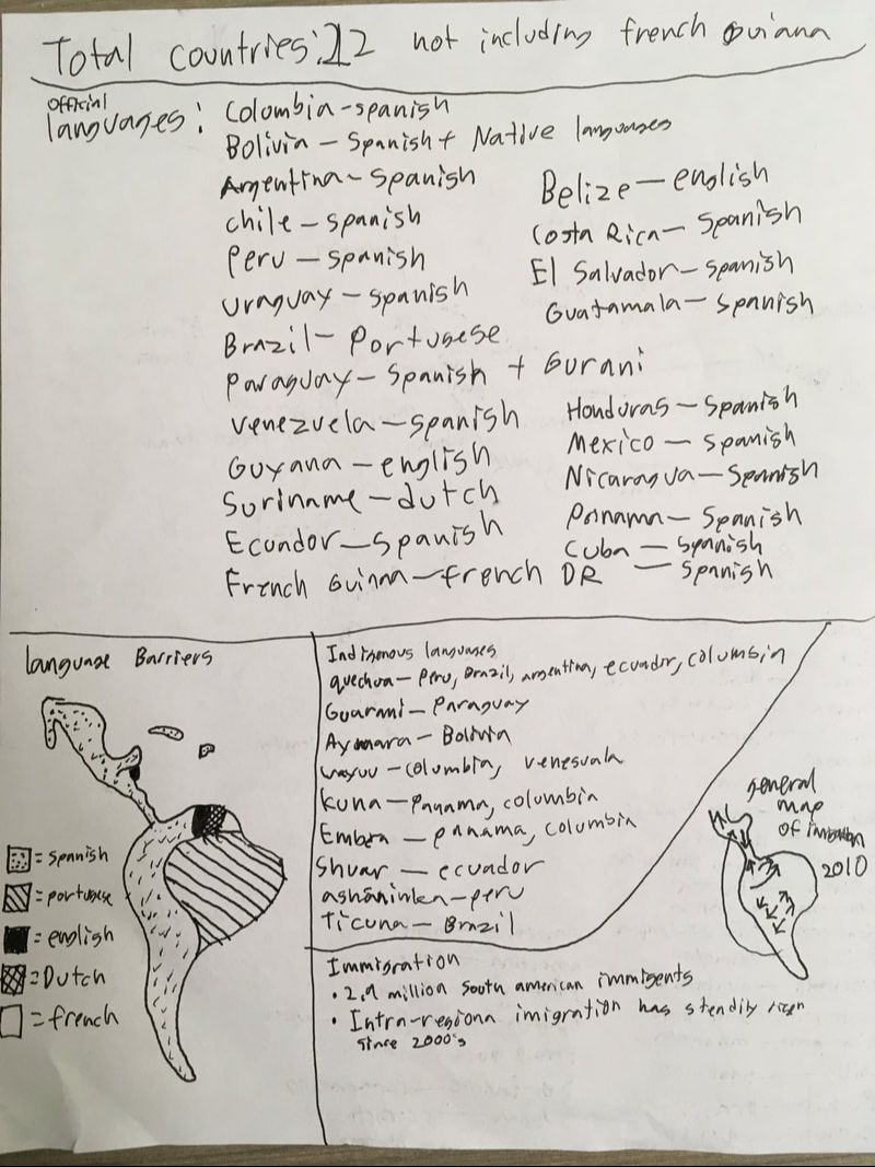
Most countries in Latin America have Spanish as their national language, with a few exceptions. Brazil speaks Portuguese, Suriname speaks Dutch, French Guiana speaks French, and Belize and Guyana speak English. There are countless native languages spoken in Latin America, some notable ones include: Quechra, Guarami, Kuna, Shuar, and Ticuna. A more complete list of languages and the countries they are found in is in the picture above.
Sources:
https://www.iom.int/south-america
https://thelanguagefactory.co.uk/the-facts-you-need-to-know-about-languages-in-latin-america/
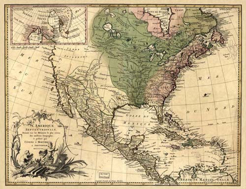
Old Map of North America
|
This 1710 map obviously favors European colonies, with very little text covering the inland areas of the continent. What's strange is that the map is written in Spanish, and was probably drawn by a Spaniard, yet the east coast (English colonies) look much more accurate than modern-day Mexico. Some of the most noticeable differences between this map and reality are Baja California (which appears much wider than it actually is) and the coastline of western north america (who's ridges are exaggerated). All of the Caribbean islands also appear larger and closer to the mainland than they actually are. These discrepancies suggest that Spain was far more concerned with their southern territories than their northern ones, and that they probably had good communication with Britain. Since this map was drawn, every colony on it (except for French Guiana) succeeded from their parent countries, and the US took the west coast from Mexico.
|
